Teide Cable Car
Please see the information, all cable car tickets have to be booked directly with the National Park.
Visit to Teide National Park
A visit to the largest national park in the Canary Islands will allow you to contemplate a volcanic landscape of unrivalled beauty Daybreak and sunset are moments of great beauty in the park and when night falls it becomes one of the best places on the planet to stargaze. The changing seasons offer indescribable spectacles, with explosions of colour from Teide white broom or Teide bugloss in springtime and the snows that cover the volcano in winter.
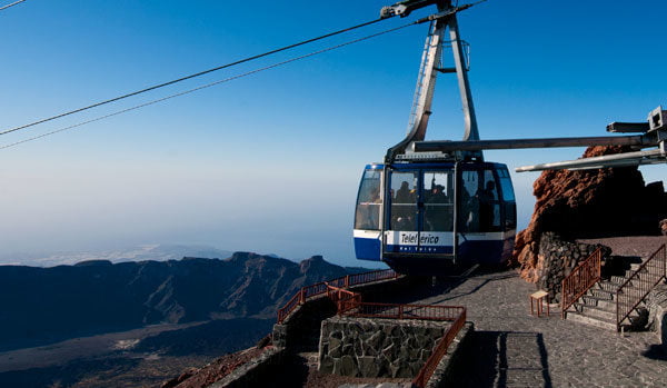
Teide Cable Car
The upper station of Teide Cable Car is the point of departure for three interesting trails for hiking enthusiasts. Pico Viejo and La Fortaleza provide spectacular views of the south and north of the island, respectively. The ascent to the peak leads to the highest point of the volcano at an altitude of 3,718 m, the tallest peak in Spain. To visit the peak you must apply for a permit at www.reservasparquesnacionales.es
Teide Crater Trail, Telesforo Bravo, #10
The Teide crater route takes you to the tallest summit in Spain. It starts at the upper station of the cable car following the path toward La Fortaleza Lookout, where you can immediately see a trail to the left which starts to climb the steep slope of Teide Peak. The altitude and the strong smell of sulphur emitted by the numerous fumaroles you will find make it a difficult ascent, so you should climb slowly, taking advantage of brief rests to feel beneath your feet the sounds of the island and the brisk summit air.
Making tight turns the trail climbs the south-eastern slope, drawing ever closer to the long awaited ridge from which you can, finally, contemplate the mysterious interior of the crater. Once at the top, the yellow-green depths of the Teide crater will make us imagine the violent eruptions of the past. La Palma, El Hierro, La Gomera, Gran Canaria, Fuerteventura and Lanzarote are visible from this point.
The permit to climb to Teide Peak must be obtained ahead of time at www.reservasparquesnacionales.es
La Fortaleza Lookout Trail, #11
The La Fortaleza Lookout route heads north-east, leading to the most perfect side of Teide’s volcanic cone, a steep slope that in few kilometres enters into the depths of the ocean. It is almost a flat trail, but the altitude may make you feel tired. Teide’s cone is on the left-hand side and on the right the clean brilliant slopes of Montaña Blanca can be observed, along with the black lava flow, which bears witness to old eruptions, and through which Trail #7 (to Altavista Mountain Refuge) climbs. From this incredible lookout point, we can observe the entire northern face of the island of Tenerife. La Orotava Valley is in the centre and in the distance the long La Esperanza mountain range disappears into the wild Anaga mountain mass. Your attention will be drawn to the small white points that are the domes of the Teide Astrophysics Observatory and the Izaña Astmospheric Observatory. The reddish crest of Los Riscos of La Fortaleza mark the edge of the extensive La Orotava pine forest, passing from the green of its tree tops to the intense blue of the Atlantic Ocean.
Pico Viejo Lookout Trail, #12
Practically flat and perfectly settled, the path of the Pico Viejo Lookout heads toward the western slope of El Pilón, where it contemplates the Montaña Chahorra crater, with a diameter of 800 m and at al altitude of 3,104 m, also known as Pico Viejo. The last historic eruption of Teide occurred in 1798, emitting rivers of lava during three months through the craters known as “Las Narices del Teide” (Teide’s nostrils).
The route is itself a magnificent lookout for the entire southern slope of the island, making it easy to observe the configuration of the giant caldera and its natural enclosure of rocky vertical walls, among which the mass of Montaña Guajara stands out. From here you can see how the lava tongues slid down the slopes of the volcano to the area surrounding the walls of the circus, and the numerous cañadas which surround the caldera can be observed along with the vertical formations of Los Roques de García. The trail ends at the lookout, which provides a wonderful view of the multi-coloured Pico Viejo crater and Los Gemelos and you can also spend some time following the southern coast of the island, picking out the towns, large tourist locations, the airport and, a bit closer, the marvellous Vilaflor pine forest. You will feel like you can reach out and touch La Gomera, with El Hierro and La Palma a bit farther in the background.
Highlights
- Ascend the highest peak in Spain by cable car
- Enjoy Teide National Park’s spectacular vistas
- Choose from three possible trails to hike along the summit
- 10% discount between 15.00 and 16.00 h buying your ticket online
What’s included
- Quick entry into Teide Cable Car without waiting in line
What’s not included
- Permits to ascend to Teide Peak must be obtained at www.reservasparquesnacionales.es
- A Guide
Additional Information
Schedule:
-
- From 9.00 to 16.00 in winter
- From 9.00 to 17.00 in summer
Last trip
-
-
- At 16.00 h
-
Parking:
-
-
-
- Yes
-
-
Stores:
-
-
-
- Yes
-
-
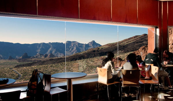
Restaurant / Café
-
-
-
- Yes
- Restrooms:
- Yes
-
-
Restrictions:
Teide Cable Car is located within a protected national park and therefore we must follow a series of basic rules of civic behaviour and respect for the natural environment, such as not leaving garbage behind or taking rocks, plants or animals. It is prohibited to make fires, loud noises or to camp.
How to dress:
When visiting the volcano we recommend using appropriate clothes and footwear which will allow you to walk on rocky terrain and protect you from changes in temperature.
The Weather:
You should be prepared for extremes in weather, both heat as well as cold, depending on the time of year.
Observations:
The trails are the best way to move around the volcano and you should stay on them. Of the three routes – #10, #11 and #12- only #10, leading to Teide Peak, requires a free permit which is given by Teide National Park’s administration, which can be requested on-line at www.reservasparquesnacionales.es. Remember that this permit must be applied for with enough time before your visit, so if you wish to visit the peak the first thing you should do is make sure there are available reservations.
Recommendations:
-
-
-
- Wear warm clothing and proper footwear.
- Protect yourself from sunstroke.
- Due to the elevated luminosity, wear sunglasses.
- Take plenty of water on hikes.
- People with health problems should consult with their doctors before undertaking this hike.
-
-
Where to find us
Street: Carretera TF-I, Km. 40.2 – Teide National Park
Postal Code: 38300
Municipality: La Orotava
How to get there:
Teide Cable Car is well connected by roads, and can be easily reached from any point of the island.
If you are in the northern part of the island
-
-
-
- Take highway TF-21 which connects La Orotava with El Portillo de la Villa, and cross all of Teide National Park. The Cable Car is at KM 43. (N28º 15′ 17″ W16º 37′ 33″)
- Take highway TF-23 from Boca de Tauce to Chío, which connects with TF-21.
- Bus Line 348 Puerto de La Cruz – Las Cañadas del Teide (www.titsa.com). Departure times: 09.15 h from Puerto de la Cruz, with stops in La Orotava, Montaña Blanca (trail to the Altavista Mountain Refuge) and Teide Cable Car and return from Teide Cable Car departing at 16.00 h.
-
-
If you are in the southern part of the island
Take highway TF-21 from Vilaflor to Teide National Park; this is the route to take if coming from the tourist areas Playa de Las Américas and Los Cristianos.
Bus Line 342 Playa de Las Américas – Las Cañadas del Teide (www.titsa.com). Departure times: 09.15 h. from Las Américas, with a stop in Los Cristianos (09.30h). Teide Cable Car and Montaña Blanca (trail to the Altavista Mountain Refuge) and return from the cable car departing at 15.30 h.
If you are close to Santa Cruz or La Laguna
-
-
-
- Take highway TF-24 from La Laguna to Portillo de la Villa (La Esperanza Highway), which connects with TF-21 that will take you to the lower station of the cable car at km 43
-
-
Distances:
-
-
- Santa Cruz: 64 Km
- La Laguna: 55 Km
- Puerto de la Cruz: 45 Km
- Los Gigantes: 52 Km
- Los Cristianos: 47 Km
- El Médano: 52 Km
-


